How Wildlife Drones Became Kaziranga’s Best Defence for Saving Rhinos From Poachers
Think rhino protection, and you probably picture forest guards in khaki trekking through thick jungle, armed with binoculars and decades of field knowledge. But at Kaziranga National Park in Assam, the frontline of wildlife conservation now includes sleek, buzzing drones. These high-tech gadgets are no longer just tools for wedding photographers or surveillance teams, but they’ve become a critical part of guarding India’s largest population of one-horned rhinos.
Rhino poaching in Kaziranga National Park was once a grave concern, with over 190 rhinos killed between 2000 and 2021. The crisis peaked in 2013 and 2014 when 27 rhinos were poached each year. However, a determined crackdown by forest officials and the introduction of technology like drone surveillance have turned the tide. Since 2016, poaching incidents have declined by 86 percent.
Kaziranga isn’t just any park. It’s home to over 2,600 one-horned rhinos and attracts global attention for its conservation success. But with that success comes a constant threat, especially from poachers looking to cash in on the rhino horn trade. The vast terrain, thick vegetation, and seasonal floods make it nearly impossible for on-ground patrol teams to monitor every corner. That’s where drones come in.
How drones are changing the game
Drone surveillance in Kaziranga first took off around 2013 as an experimental project. The results were promising, (Park officials report a 40 percent drop in illegal hunting and unauthorised entry within drone-covered zones) and by 2017, the Central Government approved the use of unmanned aerial vehicles (UAVs) for regular monitoring.
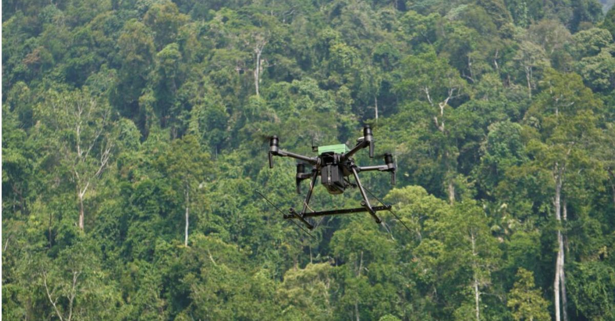 These drones have evolved from short-range gadgets into powerful tools that fly up to 60 minutes at a stretch. Picture source: Pexels
Since then, these drones have evolved from short-range gadgets into powerful tools that fly up to 60 minutes at a stretch and cover large swathes of forest, even at night.
Equipped with thermal imaging and real-time video streaming, drones help spot suspicious activity, locate animals during floods, and keep an eye on hard-to-reach areas without disturbing the wildlife. During monsoons, when much of Kaziranga gets submerged, drones have also been used to track rhinos migrating to higher ground—information that helps rangers direct rescue or support efforts.
Who’s flying these drones?
Each of Kaziranga’s four ranges now has a drone unit. Park officials and Assam police have undergone specialised training to operate them, ensuring drones are flown with legal and ecological care. Surveillance footage can be used for real-time response as well as in legal cases against poachers or trespassers.
While catching poachers is a key part of the job, drones are also helping park authorities beyond security. They’re being used to:
- Map vegetation and monitor habitat change: Kaziranga is a dynamic ecosystem and seasonal floods, river shifts, and plant growth patterns constantly reshape the landscape. Drones offer a bird’s-eye view that helps forest officials keep track of these changes over time. With high-resolution cameras, they can map grasslands, track the spread of invasive species, monitor the growth or loss of tree cover, and identify areas in need of reforestation or restoration.
- Track injured or stranded animals during natural disasters: During the monsoons, large parts of Kaziranga get submerged. Animals instinctively move to higher ground, often crossing highways or venturing near human settlements in search of safety. In these situations, drones become vital rescue tools. They help locate animals in distress, those separated from herds, stuck in floodwaters, or showing signs of injury. This real-time visibility allows forest teams to respond faster and more precisely, sometimes even coordinating with veterinary teams or setting up temporary safe zones.
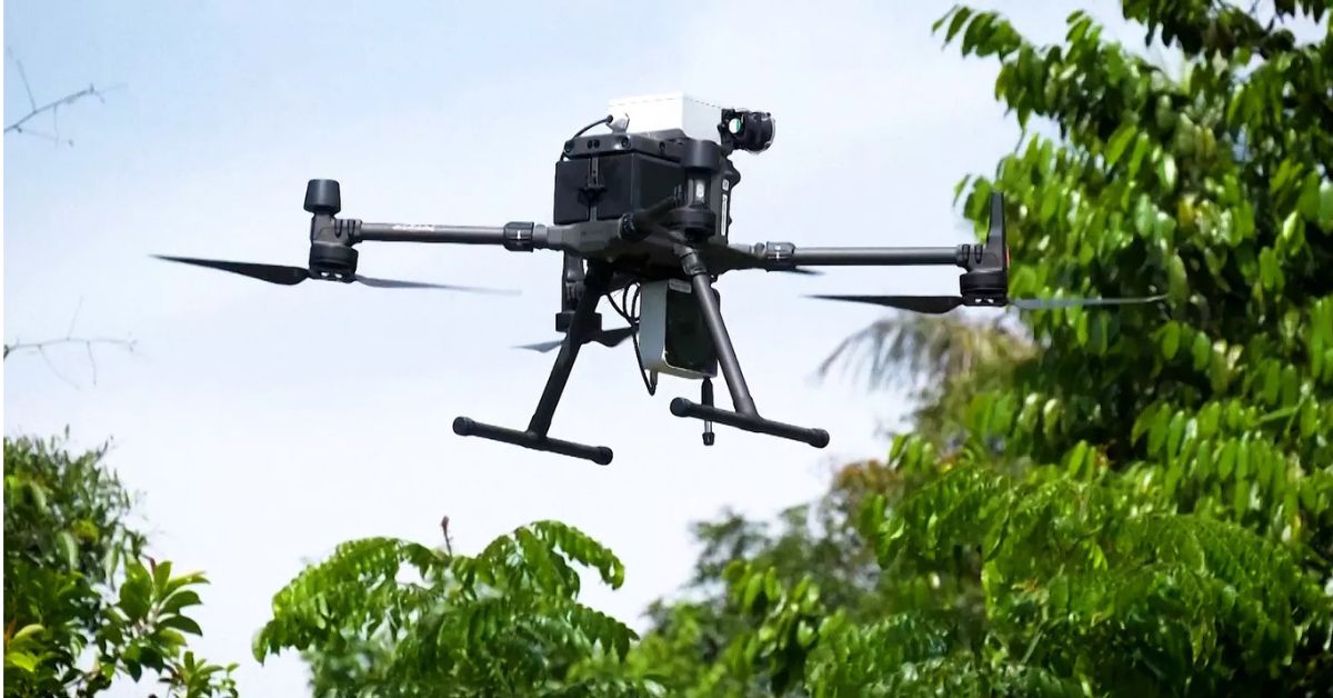 Drones offer a bird’s-eye view that helps forest officials keep track of these changes over time. Picture source: Pixabay
- Detect early signs of forest fires: Forest fires are rare but potentially devastating in Kaziranga. (In 2005, a devastating forest fire destroyed 20 percent of the grasslands and jungle area; since then, regular controlled burning of the excessive grassland has been carried out.) Drones equipped with thermal sensors can detect rising temperatures or smoke signatures before the flames become visible to the naked eye. Early detection means officials can deploy firefighting resources before the situation escalates, protecting both wildlife and valuable forest cover.
- Reduce human-wildlife conflict by tracking animal movement near settlements: Kaziranga shares its borders with multiple villages, and sometimes animals, especially elephants, rhinos, and wild boars, wander into farmlands or settlements, leading to panic or property damage. Drones help track these movements in real-time and alert response teams or local communities in advance.
Compared to helicopters or manned patrols, drones are cost-effective and safer. They also allow a much faster response during emergencies and natural disasters.
Chalking a smarter and safer future for the rhinos
Of course, it’s not without its challenges. Tree canopies can interfere with GPS signals, and drones need regular maintenance and upgrades to keep up with environmental conditions. There’s also a need to ensure that drone flights don’t stress the animals or disrupt their natural behaviour.
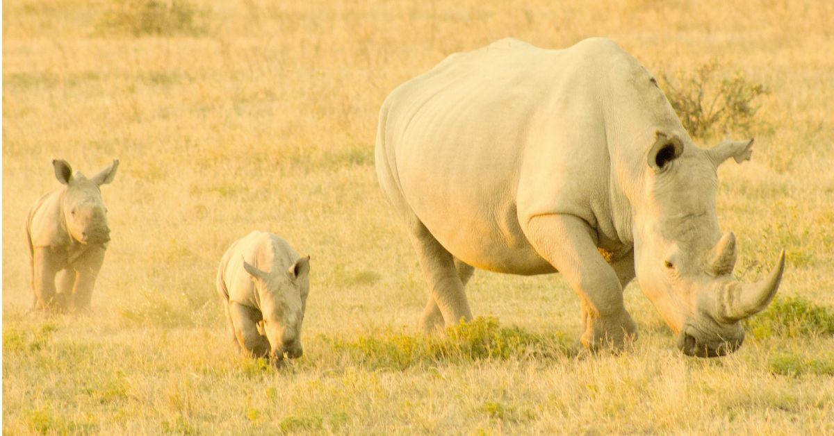 Home to over 2,600 one-horned rhinos, Kaziranga attracts global attention for its conservation success. Picture source: Pexels
But the park’s success in integrating drones into its operations shows that with the right training and planning, tech can play a vital role in conservation. In fact, Kaziranga is one of the first protected areas in India to formally adopt drone surveillance on a wide scale, a move that could inspire similar practices in other national parks and reserves.
Some reserve forests have also taken up drone technology to monitor the extensive land:
- Sundarbans (West Bengal): Drones are deployed to monitor tiger and crocodile movement across the mangrove landscape, especially in conflict-prone zones where human-animal interactions are high. They’re also used to track illegal fishing or logging activities.
- Nagarhole and Bandipur National Parks (Karnataka): Forest departments have started using drones alongside camera traps to track elephants and tigers, especially in buffer zones near human settlements. This has helped mitigate man-animal conflict by giving early alerts of animal movement.
- Chhattisgarh Forest Department: Drones were used to monitor dense forest patches in Barnawapara and Udanti-Sitanadi Tiger Reserves to detect illegal mining and timber felling.
- Gir National Park (Gujarat): The home of the Asiatic lion, Gir uses drones to assist patrolling in remote areas, particularly during the monsoon when access is difficult on foot.
Edited by Saumya Singh
News