Cyclone ‘Montha’ update: Well-marked low-pressure area over Bay of Bengal intensifies into depression
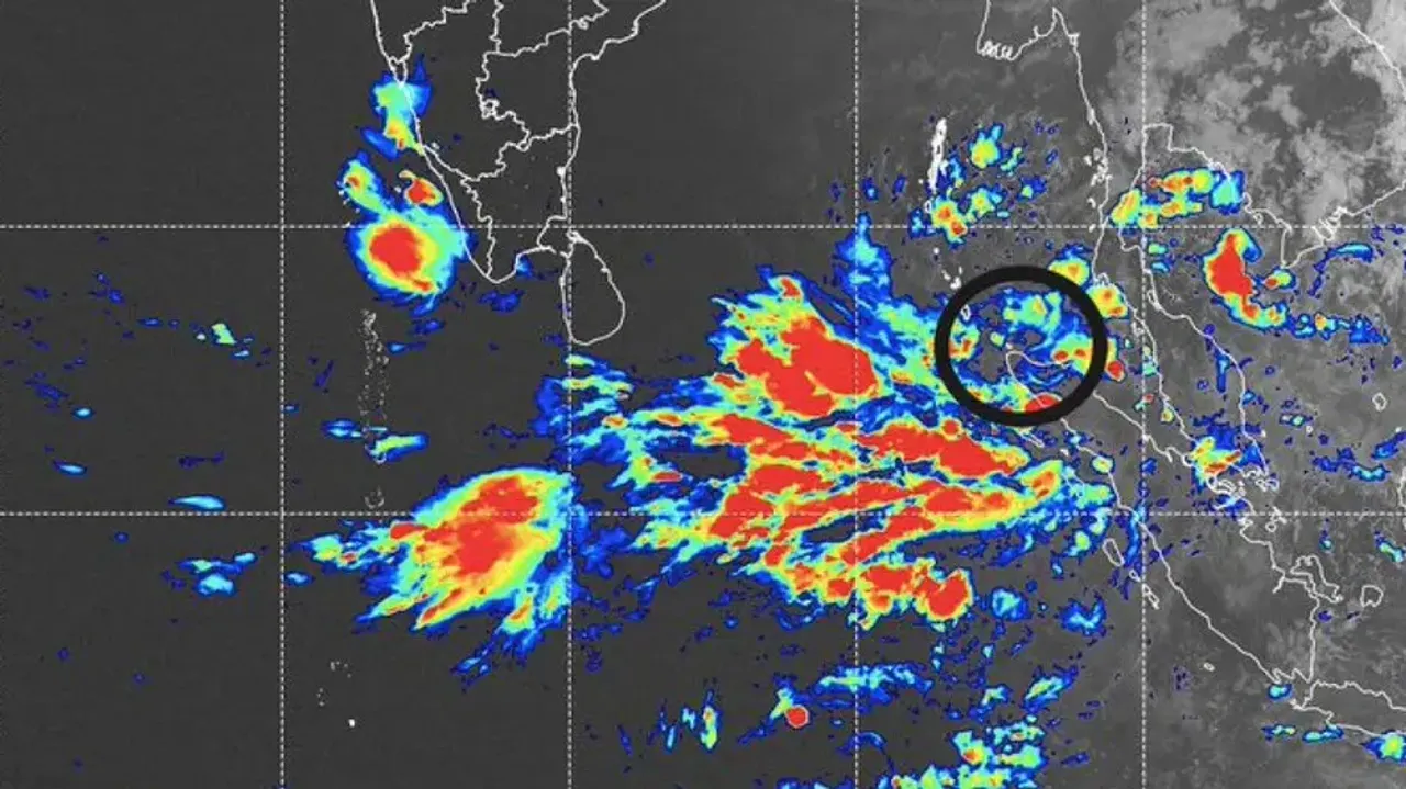
The well-marked low-pressure area over the Bay of Bengal has intensified into a depression, raising alerts across coastal and southern Odisha.
According to the India Meteorological Department (IMD), the system is gradually gaining strength and is expected to further intensify into a deep depression over the next 24 hours.
Clarity On Landfall Soon
The depression is currently moving in a west-northwest direction, though its exact landfall point remains uncertain. While the cyclone’s core is likely to have a stronger impact over coastal Andhra Pradesh, Odisha is expected to experience heavy to very heavy rainfall, gusty winds, and localised thunderstorms.
The Regional Meteorological Centre in Bhubaneswar has issued weather warnings for several districts. On October 27, a yellow alert is in force for Kendrapara, Jagatsinghpur, Cuttack, Khordha, Puri, Nayagarh, Ganjam, Gajapati, Rayagada, Koraput, and Malkangiri.
An orange warning for heavy rainfall has also been issued for Cuttack, Kendrapara, Jagatsinghpur, Khordha, Puri, and Ganjam for October 28. On October 29, Mayurbhanj, Balasore, and Bhadrak have been placed under orange alert as well.
IMD officials have also issued thunderstorm and lightning warnings for select areas, with wind speeds expected to reach 60–70 kmph. Fishermen have been strictly advised not to venture into the sea starting October 26, as rough sea conditions are expected.
Also Read: Cyclone ‘Montha’ brewing over Bay of Bengal, IMD issues alert for Odisha
The weather system is likely to weaken gradually from October 30, with conditions improving as it moves inland. Residents and authorities have been urged to remain alert and take precautions, especially in low-lying and coastal areas, as heavy rain may trigger localised flooding.
News