How India is Using AI & Tech To Save Wildlife From Illegal Poaching
In the dense forests of India, where the calls of wild elephants echo and tigers silently patrol their territories, an invisible threat lurks — one that doesn’t announce itself with roars or footprints. Poaching, illegal wildlife trade, and escalating human-animal conflict continue to endanger not just India’s iconic species but also the fragile relationship between communities and the forests they call home.
For years, forest guards, researchers, and conservationists have relied on sheer grit and intuition to protect these ecosystems. But in a country as vast and diverse as India — where forest staff are often outnumbered and under-resourced — the stakes have risen too high for traditional methods alone. The question is no longer whether we can protect our wildlife, but how fast and how smartly we can do it. This is where artificial intelligence and digital innovation are stepping in.
From AI-powered camera traps that can distinguish a tiger from a trespasser in seconds, to apps that predict when and where elephants might enter farmland, technology is helping people on the ground act faster, prevent conflict, and gather evidence that holds up in court. Here are five inspiring AI-driven efforts that are revolutionizing conservation.
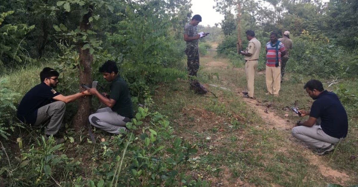
1. TrailGuard AI: Silent guardian in tiger corridors
 TrailGuard is an AI-powered camera system designed to detect poachers in real time and alert forest authorities before a threat escalates. Picture source: news.clemson.edu
What it does
TrailGuard AI deploys compact, AI-enabled camera units across vulnerable wildlife corridors — especially in tiger reserves like Similipal, Kanha‑Pench, and Dudhwa — to detect poachers and wildlife in real time. In Similipal Tiger Reserve, deploying around 100 to 150 units led to 96 poacher arrests and 86 firearms seized within ten months, and an estimated 80 percent reduction in poaching incidents.
How it works
Each camera combines a pen-sized imaging unit with a battery the size of a notepad. It remains in low-power mode until motion is detected, then uses embedded AI to classify the object (human, tiger, elephant, vehicle, etc.) and transmits photos via cellular or satellite within 30 to 40 seconds. These alerts are sent to a control centre, WhatsApp groups, and radio channels.
Forest rangers are then dispatched promptly, enabling both village warning and anti-poaching operations. The quick detection cycle, alongside on-ground intelligence, has led to real arrests and stronger enforcement actions.
Takeaways
- Rapid response saves lives: Quick alerts give rangers and villagers crucial time to act.
- Communities benefit too: Villagers get early warning, reducing conflict risk.
- Edge AI scales easily: Deployable across any human-wildlife interface.
2. HAWK App: Smart patrols, smarter reports
What it does
HAWK is a comprehensive digital incident-reporting and surveillance app developed by Leopard Tech Labs in partnership with the Wildlife Trust of India. Used by forest departments in Karnataka, Kerala, and Tamil Nadu, HAWK replaces paper-based records, streamlines crime reporting, and compiles evidence for legal proceedings.
How it works
The application features GPS-powered patrol monitoring to highlight wildlife-crime hotspots. Officers log incidents via the app, attaching geo-tagged photos and auto-generating court-ready reports. Its modular design supports specialised functions including CyberHAWK for digital intelligence, SARPA application for snake rescues (an app to provide rapid support for snake bite incidents), Jumbo Radar for elephant movements, and WildWatch for predictive alerts based on agricultural cycles and rainfall patterns.
With better data, forest teams can identify crime trends, coordinate preventive actions, and secure more convictions under wildlife laws.
Takeaways
- Digitisation empowers enforcement: Dynamic data replaces slow paper systems.
- Predictive is preventive: Alerts based on farming patterns and seasons.
- Modular by design: Can be extended to rescue, tracking, and conflict mitigation.
 AI-powered apps are now helping conservationists predict animal movement patterns and prevent human-wildlife conflict before it begins. Representational Image. Picture source: a-zanimals.com
3. DeCaTron: AI sorting of camera-trap data
What it does
DeCaTron is an AI-based platform launched by Telangana’s government to automatically process millions of camera-trap images. It identifies different wildlife species, enabling faster monitoring of biodiversity and detecting unusual activity that could signal poaching.
How it works
Camera-trap photos from Amrabad and Kawal Tiger Reserves are uploaded to DeCaTron, where AI algorithms classify them by species, eliminating the need for officers to manually review each image. In a one-week pilot, the system automatically processed four million images, helping highlight species presence and potential threat zones without requiring forest staff to walk through dense terrain.
Takeaways
- Automation is essential: AI drastically reduces human labor.
- Resource optimisation: Forest staff can focus on field operations.
- Highly scalable: Applicable wherever camera traps exist.
4. Drone Patrols in Tamil Nadu & Kerala
What it does
Drones equipped with high-resolution and thermal cameras are being deployed across 13 forest ranges in Tamil Nadu, with Kerala planning similar operations. These drones help monitor elephant movements, track forest fires, and deter poachers in difficult-to-access areas.
How it works
The drones are outfitted with 48 megapixel cameras, thermal sensors, GPS trackers for location, laser-range finders, searchlights, and loudspeakers. Capable of performing night surveillance, they issue alerts to forest staff and nearby villages upon detecting wildlife or fire. Tasks that earlier required up to 20 days on foot can now be completed in just half a day. Trained drone pilots from each range ensure efficient operation and timely data delivery for response planning and habitat mapping.
Takeaways
- Eyes in the sky: Drones cover inaccessible and vast terrains quickly.
- Tech-equipped field staff: Drones supplement ranger patrols.
- Faster response: Alerts villagers when wildlife moves near settlements.
 By using AI to analyse movement data and environmental patterns, wildlife conservation teams can now anticipate conflict zones and intervene before animals and humans cross paths. Image source: wildlifeconservationtrust.org
5. Operation Shikkar: Digital forensics meets ivory smuggling
What it does
Operation Shikkar (2015–17) was a large-scale anti-ivory task force led by the Kerala Forest Department and Wildlife Trust of India. The operation aimed to dismantle ivory smuggling networks by digitizing intelligence and applying forensic analysis, resulting in the arrest of 72 individuals and the seizure of 487 kg of ivory.
How it works
Investigators converted paper intelligence into digital databases and used forensic analysis to trace communication networks and transaction trails. This approach helped identify key syndicate members, coordinate simultaneous raids across multiple locations, and secure high-value seizures. The collaborative effort between NGOs, forest officials, and police led to timely arrests, prosecutions, and raised wider awareness about the ivory trade.
Takeaways
- Intelligence saves ivory: Data-driven tracking dismantles trafficking networks.
- Collaboration is critical: NGOs and forest departments working together create impact.
Edited by Saumya Singh
News